Geographical Location: Absolute and Relative Aspects - kapak
Eğitim#geography#geographical location#kpss#turkey

Geographical Location: Absolute and Relative Aspects

An academic overview of absolute and relative geographical location, focusing on key concepts and their application to Turkey's geography, relevant for the KPSS examination.

firdevs14March 1, 2026 ~24 dk toplam
01

Sesli Özet

8 dakika

Konuyu otobüste, koşarken, yolda dinleyerek öğren.

Sesli Özet

Geographical Location: Absolute and Relative Aspects

0:008:10
02

Flash Kartlar

25 kart

Karta tıklayarak çevir. ← → ile gez, ⎵ ile çevir.

1 / 25
Tüm kartları metin olarak gör
  1. 1. What is the fundamental concept of Geographical Location?

    Geographical location is a fundamental concept in geography that defines the position of any point or region on the Earth's surface. It is crucial for understanding the physical, climatic, and geopolitical characteristics of any given area. It is broadly categorized into absolute and relative types, providing a foundational framework for geographical analysis.

  2. 2. What are the two primary types of geographical location?

    The two primary types of geographical location are absolute geographical location and relative geographical location. Absolute location refers to a precise, fixed position using a coordinate system of latitude and longitude. Relative location describes a place's position in relation to other features or entities, emphasizing its connections and interactions within its surroundings.

  3. 3. Define absolute geographical location.

    Absolute geographical location refers to the precise, fixed position of a place on the Earth's surface. It is determined by a coordinate system of latitude and longitude, allowing for the unambiguous identification of any point. This system provides a unique and unchanging address for every location on the globe.

  4. 4. What are the two main components used to determine absolute geographical location?

    The two main components used to determine absolute geographical location are latitude and longitude. Latitude measures angular distance north or south of the Equator, while longitude measures angular distance east or west of the Prime Meridian. Together, they form a precise coordinate system that allows for the exact pinpointing of any location.

  5. 5. Explain what latitude represents in geographical terms.

    Latitude represents the angular distance north or south of the Equator, measured by parallel circles. It ranges from 0 degrees at the Equator to 90 degrees at the poles. Latitude is crucial as it dictates the angle of incidence of solar rays, significantly influencing climate zones and temperature distribution across the Earth.

  6. 6. What is the range of latitude and what are some key parallels?

    Latitude ranges from 0 degrees at the Equator to 90 degrees at the poles, both North and South. Key parallels include the Equator (0°), the Tropics of Cancer (23.5° N) and Capricorn (23.5° S), and the Arctic (66.5° N) and Antarctic (66.5° S) Circles. These parallels mark significant climatic and astronomical boundaries on Earth.

  7. 7. How does latitude influence the angle of incidence of solar rays and temperature?

    Latitude directly dictates the angle of incidence of solar rays. Closer to the Equator, solar rays hit the Earth more directly, leading to higher temperatures. As latitude increases towards the poles, the angle becomes more oblique, spreading solar energy over a larger area and resulting in a general decrease in temperature. This directly impacts the formation of distinct climate zones.

  8. 8. Describe the influence of latitude on the duration of day and night.

    Latitude significantly affects the duration of day and night. Near the Equator, day and night lengths are relatively constant throughout the year, approximately 12 hours each. However, as one moves closer to the poles, the variations in day and night duration become more pronounced, with extreme differences during summer and winter solstices, including periods of continuous daylight or darkness.

  9. 9. How does latitude impact the length of shadows?

    Latitude influences the length of shadows cast by objects. The sun's angle changes with latitude and throughout the year, causing shadow lengths to vary. Closer to the Equator, the sun is higher in the sky, resulting in shorter shadows, especially at noon. Towards the poles, the sun's angle is lower, leading to longer shadows, which also change with the seasons.

  10. 10. Explain what longitude represents in geographical terms.

    Longitude represents the angular distance east or west of the Prime Meridian, which passes through Greenwich, England. It is measured by meridians, which are semi-circles running from pole to pole. Longitude ranges from 0 degrees at the Prime Meridian to 180 degrees east or west, and its primary impact is on local time determination.

  11. 11. What is the range of longitude and where is the Prime Meridian located?

    Longitude ranges from 0 degrees at the Prime Meridian to 180 degrees east or west. The Prime Meridian, which serves as the reference point for longitude, is located in Greenwich, England. This meridian divides the Earth into Eastern and Western Hemispheres and is fundamental for establishing global time zones.

  12. 12. What is the primary impact of longitude on geographical phenomena?

    The primary impact of longitude is on local time. As the Earth rotates, different longitudes experience sunrise and sunset at different times. This principle is fundamental to the establishment of time zones, where each 15 degrees of longitude generally corresponds to a one-hour difference in local time, with eastern longitudes having earlier times.

  13. 13. How does Earth's rotation relate to time differences based on longitude?

    The Earth rotates 360 degrees in approximately 24 hours. This means that for every 15 degrees of longitude the Earth rotates, one hour passes. Consequently, places to the east of a given meridian experience earlier local times, while those to the west experience later times, forming the basis for global time zones and the International Date Line.

  14. 14. What is Turkey's absolute latitudinal position?

    Turkey's absolute latitudinal position is approximately between 36 degrees North and 42 degrees North. This places the country entirely within the Northern Hemisphere. This specific latitudinal band is crucial for defining its climatic characteristics, seasonal variations, and position within the temperate zone.

  15. 15. How does Turkey's latitudinal position influence its climate and seasons?

    Turkey's latitudinal position between 36°N and 42°N places it entirely within the Northern Hemisphere's temperate zone. This positioning is responsible for the country experiencing four distinct seasons: spring, summer, autumn, and winter. It also contributes to a variety of temperate climate types, such as Mediterranean, continental, and Black Sea climates, due to varying solar angles throughout the year.

  16. 16. What is Turkey's absolute longitudinal position?

    Turkey's absolute longitudinal position spans from approximately 26 degrees East to 45 degrees East. This eastern longitude places it significantly ahead of the Prime Meridian in terms of time. This range determines its position within the global time zone system and influences its local time relative to other countries.

  17. 17. How does Turkey's longitudinal position affect its time?

    Turkey's longitudinal position from 26° East to 45° East places it ahead of the Prime Meridian in terms of time. Due to the Earth's rotation, locations to the east experience earlier local times. Currently, Turkey observes a single standard time zone, UTC+3, which is based on a central meridian within its longitudinal extent, ensuring a unified national time.

  18. 18. What is Turkey's current standard time zone?

    Turkey currently observes a single standard time zone, which is UTC+3. This time zone is based on a central meridian within its longitudinal extent, meaning Turkey is three hours ahead of Coordinated Universal Time (UTC). This unified time zone simplifies daily life and coordination across the country.

  19. 19. Define relative geographical location.

    Relative geographical location describes the position of a place in relation to other places, physical features, or political entities. Unlike absolute location, it is not fixed but emphasizes the connections, interactions, and relationships a place has with its surroundings. It highlights a place's context within its broader environment, shaping its economic, political, and cultural significance.

  20. 20. What is the key distinction between absolute and relative geographical location?

    The key distinction is that absolute geographical location is fixed and precise, determined by coordinates like latitude and longitude, providing an unambiguous address. In contrast, relative geographical location is dynamic and emphasizes a place's position in relation to other features, highlighting its connections, interactions, and significance within its surroundings rather than a fixed point. Absolute location is 'where it is,' while relative location is 'where it is in relation to other things.'

  21. 21. How does Turkey serve as a bridge between continents?

    Turkey serves as a natural bridge between Asia and Europe, with a portion of its territory, Thrace, located on the European continent. It also lies in close proximity to the African continent. This intercontinental position has historically made Turkey a crucial transit point for trade, migration, and cultural exchange, connecting diverse regions and civilizations.

  22. 22. Which four seas border Turkey?

    Turkey is bordered by four seas: the Black Sea to the north, the Aegean Sea to the west, the Mediterranean Sea to the south, and the internal Sea of Marmara. The Sea of Marmara connects the Black Sea to the Aegean via the strategically vital Turkish Straits, forming a crucial maritime network around the country.

  23. 23. What are the strategically vital Turkish Straits and why are they important?

    The strategically vital Turkish Straits are the Bosphorus and the Dardanelles. These straits are among the world's most important waterways, controlling access between the Black Sea and the global oceans. They are critical for international shipping, naval movements, and trade, making them a significant geopolitical choke point for regional and global powers.

  24. 24. Which countries share land borders with Turkey?

    Turkey shares land borders with eight countries. To the south, it borders Syria and Iraq. To the east, it borders Iran, Armenia, and Azerbaijan's Nakhchivan exclave. To the north and west, it borders Georgia, Bulgaria, and Greece. This extensive network of neighbors places Turkey at the heart of complex regional dynamics and interactions.

  25. 25. What is the geopolitical significance of Turkey's relative location as an energy corridor?

    From a geopolitical perspective, Turkey's relative location is paramount as it functions as a key energy corridor. It facilitates the transit of oil and natural gas from the resource-rich Caspian Sea region, Central Asia, and the Middle East to European markets. This role significantly enhances its strategic importance in global energy security and international relations.

03

Bilgini Test Et

15 soru

Çoktan seçmeli sorularla öğrendiklerini ölç. Cevap + açıklama.

Soru 1 / 15Skor: 0

What are the two primary types of geographical location discussed in the text?

04

Detaylı Özet

6 dk okuma

Tüm konuyu derinlemesine, başlık başlık.

This content is based on a YouTube video.


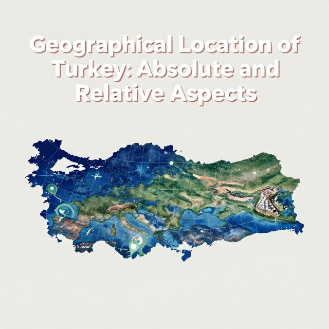
🌍 Geographical Location: Absolute and Relative Positions

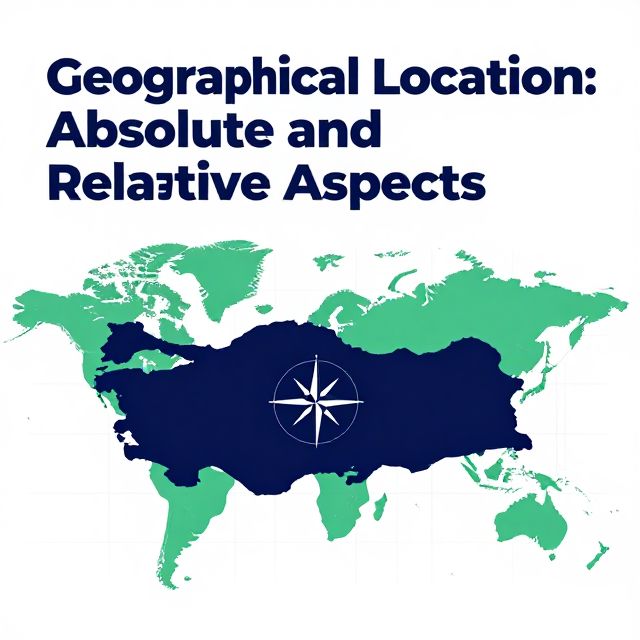
Introduction to Geographical Location 📚

Geographical location is a fundamental concept in geography, defining the position of any point or region on the Earth's surface. Understanding this concept is crucial for comprehending the physical, climatic, and geopolitical characteristics of any given area. It is broadly categorized into two primary types:

  1. Absolute Geographical Location
  2. Relative Geographical Location

This study material will systematically explore both types, detailing their components, implications, and specific relevance to Turkey's geographical profile, which holds a unique and strategically significant position.


1. Absolute Geographical Location 📍

Absolute geographical location refers to the precise, fixed position of a place on the Earth's surface. It is determined by a coordinate system of latitude and longitude, allowing for the unambiguous identification of any point.

1.1. Latitude (Parallels)

📚 Definition: Latitude measures the angular distance north or south of the Equator. These are imaginary parallel circles that run horizontally around the Earth.

  • Range: From 0 degrees at the Equator to 90 degrees at the poles (90° North at the North Pole, 90° South at the South Pole).
  • Key Parallels:
    • Equator (0°)
    • Tropic of Cancer (23°27' N)
    • Tropic of Capricorn (23°27' S)
    • Arctic Circle (66°33' N)
    • Antarctic Circle (66°33' S)

💡 Influences of Latitude:

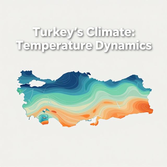
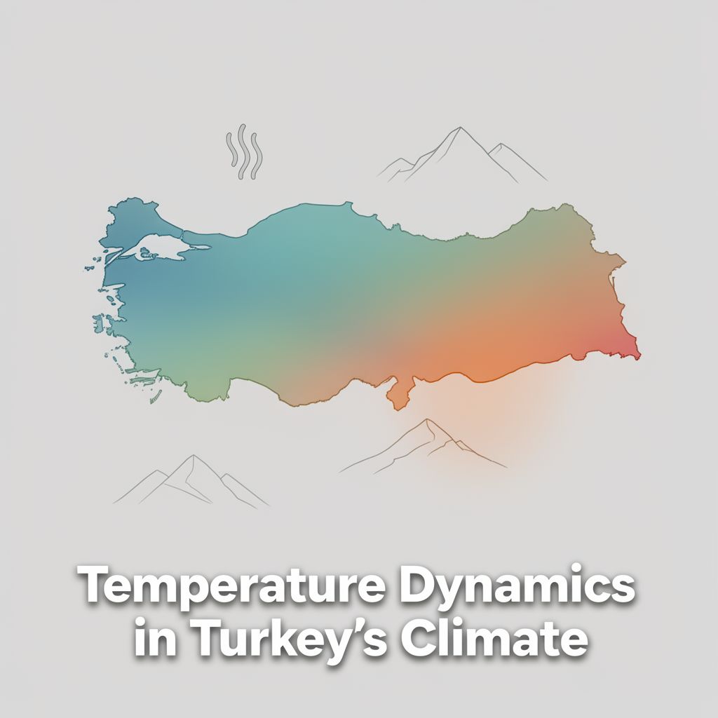
  1. Solar Rays & Temperature: Latitude dictates the angle of incidence of solar rays.
    • Solar rays hit the Equator more directly, leading to higher temperatures.
    • Temperature generally decreases from the Equator towards the poles as the angle becomes more oblique.
  2. Climate Zones: This directly impacts climate zones:
    • Tropical climates near the Equator.
    • Temperate climates in mid-latitudes.
    • Polar climates near the poles.
  3. Day and Night Duration: Latitude affects the duration of day and night.
    • Variations become more pronounced closer to the poles (e.g., polar day/night).
  4. Shadow Length: Influences the length of shadows cast by objects, which change with the sun's angle throughout the year.

✅ Turkey's Latitudinal Position (Important for KPSS):

  • Location: Turkey is situated between approximately 36 degrees North and 42 degrees North latitude.
  • Hemisphere: This places Turkey entirely within the Northern Hemisphere.
  • Climate Zone: Its position falls within the temperate zone.
  • Implications: This latitudinal placement is responsible for Turkey experiencing:
    • Four distinct seasons (spring, summer, autumn, winter).
    • A variety of temperate climate types, such as Mediterranean, continental, and Black Sea climates.

1.2. Longitude (Meridians)

📚 Definition: Longitude measures the angular distance east or west of the Prime Meridian. These are imaginary lines (meridians) that run vertically from the North Pole to the South Pole.

  • Prime Meridian: Passes through Greenwich, England, designated as 0 degrees longitude.
  • Range: From 0 degrees at the Prime Meridian to 180 degrees east or west. The 180° meridian is known as the International Date Line.

💡 Influences of Longitude:

  1. Local Time: The primary impact of longitude is on local time.
    • The Earth rotates 360 degrees in 24 hours.
    • This means each 15 degrees of longitude corresponds to a one-hour difference in local time (360° / 24 hours = 15°/hour).
    • Places to the east of a given meridian experience earlier local times.
    • Places to the west of a given meridian experience later local times.
    • This principle is fundamental to the establishment of time zones.

✅ Turkey's Longitudinal Position (Important for KPSS):

  • Location: Turkey spans from approximately 26 degrees East to 45 degrees East longitude.
  • Time Zone: This eastern longitude places it ahead of the Prime Meridian in terms of time.
  • Standard Time: Currently, Turkey observes a single standard time zone, UTC+3, which is based on a central meridian within its longitudinal extent.

📊 Combined Effect for Turkey:

The combined effect of Turkey's absolute latitude and longitude defines its fundamental position on the globe, dictating its climatic characteristics, seasonal variations, and temporal framework.


2. Relative Geographical Location 🗺️

Relative geographical location describes the position of a place in relation to other places, physical features, or political entities. Unlike absolute location, which is fixed, relative location emphasizes the connections and interactions a place has with its surroundings.

✅ Turkey's Relative Geographical Location (Crucial for KPSS):

Turkey's relative geographical location is exceptionally significant due to its unique position at the crossroads of continents and major geopolitical regions.

  1. Intercontinental Bridge:

    • Turkey serves as a natural bridge between Asia and Europe.
    • A portion of its territory, Thrace, is located on the European continent.
    • It also lies in close proximity to the African continent.
    • Historical Significance: This intercontinental position has historically made Turkey a crucial transit point for trade, migration, and cultural exchange.
  2. Surrounded by Seas:

    • Turkey is bordered by four seas:
      • Black Sea to the north.
      • Aegean Sea to the west.
      • Mediterranean Sea to the south.
      • The internal Sea of Marmara, which connects the Black Sea to the Aegean.
  3. Strategic Turkish Straits:

    • The Bosphorus and the Dardanelles are strategically vital waterways.
    • These straits are among the world's most important, controlling access between the Black Sea and the global oceans.
    • They are critical for international shipping and naval movements.
  4. Extensive Land Borders:

    • Turkey shares land borders with eight countries:
      • South: Syria and Iraq
      • East: Iran, Armenia, and Azerbaijan's Nakhchivan exclave
      • North and West: Georgia, Bulgaria, and Greece
    • This extensive network of neighbors places Turkey at the heart of complex regional dynamics.
  5. Geopolitical Significance:

    • Energy Corridor: Turkey is a key energy corridor, facilitating the transit of oil and natural gas from the resource-rich Caspian Sea region, Central Asia, and the Middle East to European markets. This role enhances its strategic importance in global energy security.
    • Historical Nexus: Historically, Turkey's landmass has been a nexus of ancient civilizations and empires, including the Roman, Byzantine, and Ottoman Empires, contributing to its rich cultural heritage and diverse demographic makeup.
  6. Environmental Diversity:

    • Its relative location contributes to its diverse climate and ecosystems, influenced by proximity to different continental and maritime air masses.

📈 Summary of Turkey's Relative Location:

Turkey's relative geographical location profoundly shapes its economic, political, cultural, and environmental interactions, making it a pivotal actor in its broader region and on the global stage.


Conclusion: Integrated Understanding of Location ✅

A comprehensive understanding of geographical location necessitates the integration of both absolute and relative perspectives.

  • Absolute geographical location, defined by precise latitude and longitude coordinates, establishes a region's fundamental position on Earth, dictating its intrinsic physical characteristics such as climate, seasonal patterns, and local time. For Turkey, its temperate zone latitude ensures four distinct seasons and varied climates, while its eastern longitude places it within a specific time zone.
  • Relative geographical location contextualizes a region within its broader environment, highlighting its connections and interactions with surrounding landmasses, water bodies, and political entities. Turkey's unique relative position as a bridge between continents, surrounded by strategic seas, and bordering numerous nations, underscores its critical geopolitical, economic, and cultural significance.

Both absolute and relative geographical locations are indispensable for a holistic analysis of any geographical entity, providing the foundational framework for further study in physical and human geography. For candidates preparing for examinations such as the KPSS, mastering these concepts is essential for interpreting the multifaceted characteristics and roles of Turkey within its regional and global context.

Kendi çalışma materyalini oluştur

PDF, YouTube videosu veya herhangi bir konuyu dakikalar içinde podcast, özet, flash kart ve quiz'e dönüştür. 1.000.000+ kullanıcı tercih ediyor.

Sıradaki Konular

Tümünü keşfet
Geographical Location of Turkey: Absolute and Relative Aspects

Geographical Location of Turkey: Absolute and Relative Aspects

This summary explores Turkey's geographical location, differentiating between absolute and relative positions. It covers parallels, meridians, and the geopolitical significance of its unique placement.

7 dk 25
Turkey's Climate: Temperature Dynamics

Turkey's Climate: Temperature Dynamics

An academic overview of temperature characteristics and influencing factors across Turkey, essential for understanding its diverse climate zones and for educational contexts like the KPSS examinations.

5 dk Özet 25 15
Temperature Dynamics in Turkey's Climate

Temperature Dynamics in Turkey's Climate

An academic overview of temperature distribution and its influencing factors across Turkey, covering geographical principles relevant to climate studies and educational curricula.

5 dk Özet 25 15
Earth Systems and Resources Overview

Earth Systems and Resources Overview

An academic summary of Earth's physical systems, including plate tectonics, soil dynamics, atmospheric composition, global climate drivers, and oceanic phenomena like ENSO.

8 dk 15 Görsel
Introduction to Geography for KPSS Examination

Introduction to Geography for KPSS Examination

This summary provides a formal academic overview of introductory geography, covering its fundamental concepts, branches, and key principles relevant for the KPSS examination.

5 dk Özet 25 15 Görsel
Introduction to Geography for KPSS-MEB AGS 2026

Introduction to Geography for KPSS-MEB AGS 2026

This audio summary provides an academic overview of foundational geographical concepts relevant to the KPSS-MEB Field Knowledge Examination, specifically focusing on introductory geography principles.

5 dk Özet 25 15 Görsel
Introduction to Geography for KPSS-AGS Examination

Introduction to Geography for KPSS-AGS Examination

This summary provides an academic overview of foundational geographical concepts relevant to the KPSS-AGS examination for prospective geography teachers in Turkey, emphasizing key principles and their educational significance.

6 dk Özet 25 15
Exploring the Australian Outback: Geography Basics

Exploring the Australian Outback: Geography Basics

Get ready for your English exam! This podcast explains the basic geography of Australia's vast and unique Outback in simple, easy-to-understand English. You'll learn about its size, climate, and key features.

3 dk Özet 25 15